
2026 ALTA/NSPS Survey Standards: A Guide to Greater Clarity in Real Estate
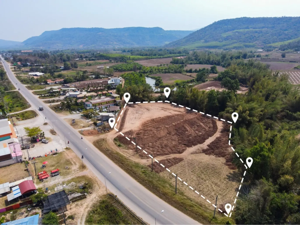
Clarity is the cornerstone of every real estate transaction, particularly concerning property boundaries. A land survey is more than a technical drawing; it is a critical document that forms the basis of trust for buyers, informs lending decisions, and allows title companies to assess risk before issuing insurance. Given the weight of these documents, the standards that govern them are vital.
The 2026 ALTA/NSPS Land Title Survey Standards are set to become the new benchmark. Updated periodically by the American Land Title Association (ALTA) and the National Society of Professional Surveyors (NSPS), these standards guide professional surveying nationwide. The latest update, effective February 23, 2026, aims to improve clarity, increase precision, and strengthen communication between surveyors and the various parties who rely on their work.
While the standards may appear highly technical, their real-world impact is significant for anyone involved in buying, selling, financing, or insuring property. This article explains the key updates in plain language, detailing why they were introduced and what they mean for modern real estate professionals and property owners.
Understanding the ALTA/NSPS Land Title Survey
An ALTA/NSPS Land Title Survey is considered the definitive standard for property surveys, surpassing a basic boundary survey in detail and scope. It integrates rigorous fieldwork, detailed records research, legal interpretation, and mapping into one authoritative picture of a property.
The primary goal is to eliminate ambiguity. The survey documents and maps everything from boundary lines and easements to encroachments, rights of way, access points, utilities, improvements, and any potential conflicts.
To maintain a consistent national standard, ALTA and NSPS regularly revise the rules that define how surveyors collect, interpret, and present information. These updates are a response to advancements in technology, evolving legal expectations, liability concerns, and feedback from attorneys, title companies, and surveyors. The 2026 update is particularly focused on enhanced transparency and clarity.
Key Updates in the 2026 ALTA/NSPS Standards
The new standards introduce meaningful refinements across three main areas:
- Enhanced Transparency and Documentation
The most notable change is a greater emphasis on transparency. Surveyors must now explicitly document elements that were previously implied. This includes:
- Explaining the reasons behind the creation of a new legal description.
- Documenting and justifying any significant difference between a measured boundary and the recorded dimension.
- Detailing why access to certain parts of the property was restricted or not possible.
This shift better reflects the surveyor’s professional judgment and makes the reasoning behind their conclusions easier for stakeholders to follow.
- Increased Precision and Clarity on Relative Positional Precision
Precision remains a central concern. ALTA continues to enforce a strict threshold for Relative Positional Precision (RPP), a statistical measure of the accuracy of the equipment used to locate boundary points. The 2026 update clarifies the calculation of RPP and stresses that precision alone does not guarantee correctness; correct boundary interpretation remains paramount.
- Stronger Reporting on Encumbrances and Access
The 2026 standards significantly improve how surveys handle easements, utilities, access, and encroachments. New requirements demand:
- More detailed notes and observations about site conditions.
- Clear distinctions between information found in documentation (public records) and physical evidence found on the site.
This refinement is a major benefit for buyers and lenders, resulting in clearer, cleaner, and ultimately more reliable survey documents.
Why the Changes Matter for Real Estate
While land surveys can often feel like a mere technical hurdle, they critically influence every aspect of a transaction, from loan approval to future property use. The new standards are designed to mitigate risk:
| Benefit | Impact on Real Estate Transactions |
| Greater Clarity = Fewer Surprises | Surveyors must now disclose all gaps or overlaps and explain differences between recorded and field measurements. This allows title companies to identify and address issues earlier, preventing delays at closing. |
| Better Lender Communication | Clearer notes, standardized formatting, and consistent explanations ensure lenders can quickly and accurately assess property risk based on the survey’s findings. |
| Protected Ownership | Updated requirements make it easier to identify undocumented property uses—such as unrecorded utility lines or informal access points—which are potential sources of future legal disputes. |
| Enhanced Legal Defensibility | The refined precision standards ensure that boundary measurements are accurate and supportable if property lines are ever legally contested. |
Common Questions on the 2026 ALTA Updates
| Question | Answer |
| Will these changes increase survey costs? | Not necessarily. While documentation time may increase, the fundamental fieldwork and measurement standards remain the same. However, more complex properties (e.g., those with many easements) may require additional effort. |
| Will updates cause closing delays? | In most cases, no. By identifying issues earlier, clearer standards should actually help prevent delays. That said, surveys involving access challenges, difficult terrain, or incomplete title documents may still require more time. |
| Are these a major overhaul? | No, they are primarily a refinement. The core structure is unchanged, but the revisions meaningfully improve ambiguity, readability, and the necessary coordination between title professionals and surveyors. |
Preparing for the 2026 Standards in Commercial Real Estate
As the 2026 standards take effect, professionals should prepare for greater clarity in survey documents and plan for a more thorough review process.
- Buyers and Brokers should pay close attention to boundary notes, easement summaries, and any discrepancies or access restrictions reported.
- Sellers should recognize that specific survey findings, especially those related to encroachments or undocumented uses, may influence negotiation terms.
The most crucial step is early and consistent communication. ALTA surveys depend heavily on the title commitment. Delays in providing the title documents to the surveyor will cause a delay in the survey. Early coordination among attorneys, title companies, and surveyors is now more important than ever.
The 2026 ALTA/NSPS Land Title Survey Standards mark a continued evolution toward greater transparency, higher precision, and enhanced collaboration within the real estate industry. While the technical details can be intricate, the practical outcome is straightforward: more reliable, understandable, and legally defensible surveys. For all parties involved—buyers, sellers, lenders, and brokers—these updates translate to fewer surprises, better-informed decisions, and ultimately, greater confidence in a smoother, clearer, and more trustworthy real estate transaction.
Compass Consultants are the premier land surveying firm in Perham, and across Minnesota as well as North and South Dakota. Let your real estate purchase start with a comprehensive land survey from Compass Consultants. Call us today!

